
City
Kayseri
Turkey
What guided this image
- Landmarks
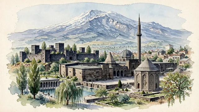
- Kayseri Castle; Hunat Hatun Complex; Döner Kümbet; Mount Erciyes; Gevher Nesibe Medical Madrasa; Anatolian; lush Central Anatolian oasis and foothill flora; Hittite and Assyrian
- Viewpoint
- Favor the classic viewpoint looking across the central park or historic square toward the black basalt walls of Kayseri Castle and the conical roof of a Seljuk kümbet with the monumental snowy pyramid of Mount Erciyes soaring in the background, showing poplar leaves and stone pavers in the foreground, the Seljuk stone monuments in the middle-ground, and the volcanic peak rising dramatically into the sky.
- Palette
- Green should be the predominant color, especially in the thick poplars and fruit orchards of the foothills, park gardens around the castle, and willow groves.
- Guarded against
- Not Konya, Ankara, or Sivas
Population1,452,458Wikidata: 1,389,680
Coordinates38.73°N, 35.49°E
Elevation1,050 m
Time zoneEurope/IstanbulUTC+3
Solar noon12:38clock runs 0.6 h ahead of the sun
Through the Earth
Dig straight through the Earth from Kayseri and you surface in open ocean, nearest to Mataura, French Polynesia — 1,774 km from the exact antipodal point.
Nearest cities in the atlas
| Adana | TR | 194 km |
| Gaziantep | TR | 249 km |
| Ankara | TR | 263 km |
| Konya | TR | 280 km |
| Aleppo | SY | 318 km |
| Diyarbakır | TR | 423 km |
| Nicosia | CY | 439 km |
| Antalya | TR | 467 km |
Twinned cities
Wikidata records no twinned cities for Kayseri inside this atlas.