
City
Guayaquil
Ecuador
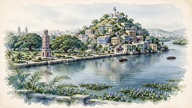
What guided this image
- Landmarks
- Las Peñas; Santa Ana Lighthouse; Guayas River; Moorish Clock Tower; Seminario Park; Guayas River; lush equatorial coastal flora; Guayas River
- Viewpoint
- Favor the classic viewpoint looking from the Guayas River or the southern end of the Malecón toward the Santa Ana Hill and Las Peñas, showing floating river hyacinths and palm fronds in the foreground, the sweeping river waters, Moorish Clock Tower, and colorful hillside houses in the middle-ground, and the Santa Ana Lighthouse crowning the hill against the soft sky in the background.
- Palette
- Green should be the predominant color, especially in the thick ficus canopies of Parque Seminario, Malecón botanical gardens, and Santay Island mangroves.
- Guarded against
- Not Quito, Cuenca, or Lima
Population2,723,665
Coordinates2.20°S, 79.89°W
Elevation4 m
Area354 km²
Time zoneAmerica/GuayaquilUTC−5
Solar noon12:20clock runs 0.3 h ahead of the sun
Through the Earth
Dig straight through the Earth from Guayaquil and you surface nearest to Rantau Prapat, Indonesia — 16 km from the exact antipodal point.
Nearest cities in the atlas
| Quito | EC | 267 km |
| Cali | CO | 730 km |
| Bogotá | CO | 995 km |
| Medellín | CO | 1,055 km |
| Callao | PE | 1,137 km |
| Lima | PE | 1,139 km |
| Panama City | PA | 1,245 km |
| San José | CR | 1,426 km |
Twinned cities
6 of 10 twinned cities are in this atlas. See the full network →