
City
Kingston
Capital of Jamaica
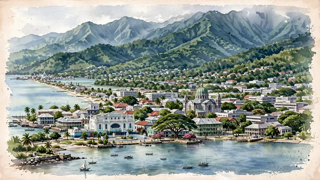
What guided this image
- Landmarks
- Blue Mountains; Kingston Harbour; Roman Catholic Holy Trinity Cathedral; New Kingston; Uptown Kingston and St. Andrew; Caribbean
- Viewpoint
- Favor an elevated viewpoint looking north or northeast across Kingston Harbour toward the city on the plain, with the monumental green ridge of the Blue Mountains rising majestically behind the urban skyline.
- Palette
- Green should be the predominant color, especially in the towering forested slopes of the Blue Mountains, urban gardens, mature trees, and waterfront vegetation.
- Guarded against
- Not a generic Caribbean resort or tropical island fantasy
Population937,700Wikidata: 580,000
Coordinates18.00°N, 76.79°W
Elevation9 m
Area22 km²
Time zoneAmerica/JamaicaUTC−5
Solar noon12:07clock runs 0.1 h ahead of the sun
Through the Earth
Dig straight through the Earth from Kingston and you surface in open ocean, nearest to Flying Fish Cove, Christmas Island — 884 km from the exact antipodal point.
Nearest cities in the atlas
| Port-au-Prince | HT | 474 km |
| Santiago de los Caballeros | DO | 662 km |
| Santo Domingo | DO | 731 km |
| Nassau | BS | 787 km |
| Barranquilla | CO | 811 km |
| Havana | CU | 815 km |
| Maracaibo | VE | 990 km |
| Panama City | PA | 1,044 km |
Twinned cities
- Shenzhen CN
1 of 6 twinned cities are in this atlas. See the full network →