
City
Bandung
Indonesia
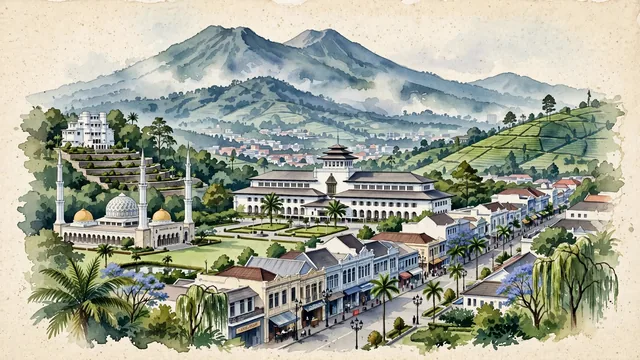
What guided this image
- Landmarks
- Gedung Sate; Tangkuban Perahu; Grand Mosque of Bandung; Villa Isola; Jalan Braga; majestic, towering tropical trees; Art Deco
- Viewpoint
- Favor the classic elevated viewpoint looking north toward Gediminas Sate and Mount Tangkuban Perahu, showing colonial tree canopies and gardens in the foreground, the graceful Art Deco facade and satay pinnacle of Gedung Sate in the middle-ground, and the rolling volcanic ridge of Tangkuban Perahu rising majestically in the background.
- Palette
- Green should be the predominant color, especially in the lush tea plantation terraces on the surrounding mountain slopes, Alun-Alun green plaza, and colonial garden trees.
- Guarded against
- Not Jakarta, Surabaya, or Yogyakarta
Population2,528,163Wikidata: 2,875,673
Coordinates6.92°S, 107.61°E
Elevation768 m
Area168 km²
Time zoneAsia/JakartaUTC+7
Solar noon11:50clock runs 0.2 h behind the sun
Through the Earth
Dig straight through the Earth from Bandung and you surface nearest to Cubará, Colombia — 32 km from the exact antipodal point.
Nearest cities in the atlas
| Bogor | ID | 98 km |
| Bekasi | ID | 103 km |
| Depok | ID | 105 km |
| Jakarta | ID | 115 km |
| South Tangerang | ID | 121 km |
| Tangerang | ID | 136 km |
| Bandar Lampung | ID | 308 km |
| Semarang | ID | 310 km |
Twinned cities
- Fort Worth US
- Liuzhou CN
- Seoul KR
- Shenzhen CN
- Suwon KR
5 of 14 twinned cities are in this atlas. See the full network →