
City
Bogor
Indonesia
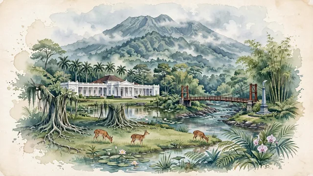
What guided this image
- Landmarks
- Istana Bogor; Mount Salak; Bogor Botanical Gardens; Kujang Monument; Sundanese; lush, rain-washed flora; Javanese
- Viewpoint
- Favor the classic viewpoint across the lawn of Kebun Raya looking toward the Istana Bogor and Mount Salak, showing giant tropical tree branches and grazing spotted deer in the foreground, the serene white palace colonnades and lotus pond in the middle-ground, and the dramatic, cloud-draped peaks of Mount Salak rising in the background.
- Palette
- Green should be the predominant color, especially in the colossal tropical trees of Kebun Raya Bogor, the manicured emerald palace lawns, and the rainforest slopes of Mount Salak.
- Guarded against
- Not Bandung, Jakarta, or Yogyakarta
Population1,078,351Wikidata: 1,030,720
Coordinates6.59°S, 106.79°E
Elevation265 m
Area119 km²
Time zoneAsia/JakartaUTC+7
Solar noon11:53clock runs 0.1 h behind the sun
Through the Earth
Dig straight through the Earth from Bogor and you surface nearest to Cabrera, Colombia — 4 km from the exact antipodal point.
Nearest cities in the atlas
| Depok | ID | 21 km |
| South Tangerang | ID | 34 km |
| Jakarta | ID | 43 km |
| Bekasi | ID | 46 km |
| Tangerang | ID | 49 km |
| Bandung | ID | 98 km |
| Bandar Lampung | ID | 213 km |
| Semarang | ID | 403 km |
Twinned cities
- Shenzhen CN
1 of 3 twinned cities are in this atlas. See the full network →