
City
South Tangerang
Indonesia
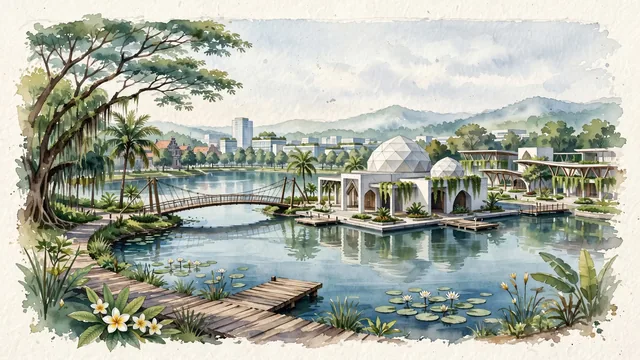
What guided this image
- Landmarks
- Situ Gintung; BSD Green Office Park and The Breeze; Al-Hakim Floating Mosque; Cisadane River; tropical Indonesian garden city flora; Indonesian
- Viewpoint
- Favor the classic viewpoint looking across the landscape toward the signature landmarks of South Tangerang, showing regional foliage and foreground textures, the iconic architectural monuments in the middle-ground, and the distant horizon fading in the background.
- Palette
- Green should be the predominant color, especially in rain trees along landscaped boulevards, royal palms, and weeping banyans around lake shores.
Population1,429,529Wikidata: 1,219,245
Coordinates6.29°S, 106.72°E
Elevation39 m
Area147 km²
Time zoneAsia/JakartaUTC+7
Solar noon11:53clock runs 0.1 h behind the sun
Through the Earth
Dig straight through the Earth from South Tangerang and you surface nearest to Oiba, Colombia — 4 km from the exact antipodal point.
Nearest cities in the atlas
| Tangerang | ID | 16 km |
| Depok | ID | 16 km |
| Jakarta | ID | 17 km |
| Bekasi | ID | 31 km |
| Bogor | ID | 34 km |
| Bandung | ID | 121 km |
| Bandar Lampung | ID | 188 km |
| Semarang | ID | 416 km |
Twinned cities
- Daejeon KR
1 of 1 twinned cities are in this atlas. See the full network →