
City
Luanda
Capital of Angola
What guided this image
- Landmarks
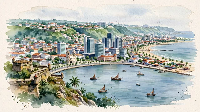
- Fortress of São Miguel; Cidade Alta; Luanda; Ilha do Cabo; Church of Our Lady of Remedies; Luanda Bay
- Viewpoint
- Favor an elevated viewpoint from the ramparts of Fortaleza de São Miguel or from Ilha do Cabo looking across the bay, capturing the curve of the waterfront, the skyline of modern towers, and the historic Cidade Alta on the plateau.
- Palette
- Green should be the predominant color, especially in the seaside palm trees along the Marginal, the wooded escarpment slopes leading up to Cidade Alta, and tropical courtyard gardens.
- Guarded against
- Not a generic African coastal city or Latin American port
Population2,776,168Wikidata: 2,165,867
Coordinates8.84°S, 13.23°E
Elevation6 m
Area113,000,000 km²
Time zoneAfrica/LuandaUTC+1
Solar noon12:07clock runs 0.1 h ahead of the sun
Through the Earth
Dig straight through the Earth from Luanda and you surface in open ocean, nearest to Napari Village, Kiribati — 982 km from the exact antipodal point.
Nearest cities in the atlas
| Pointe-Noire | CG | 476 km |
| Kinshasa | CD | 552 km |
| Brazzaville | CG | 556 km |
| Kananga | CD | 1,065 km |
| Libreville | GA | 1,108 km |
| Mbuji-Mayi | CD | 1,181 km |
| Ciudad de la Paz | GQ | 1,190 km |
| São Tomé | ST | 1,249 km |
Twinned cities
6 of 8 twinned cities are in this atlas. See the full network →