
City
Jiangyin
China
What guided this image
- Landmarks
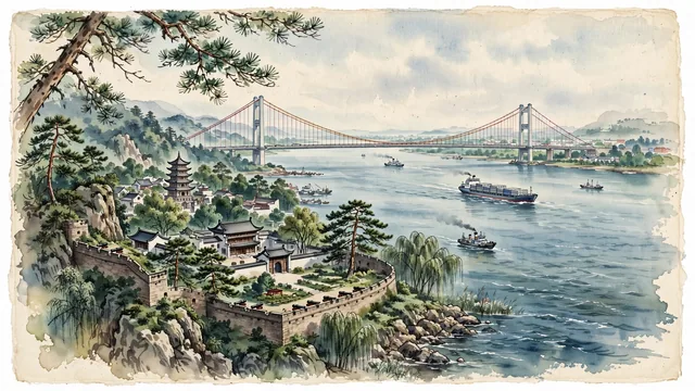
- Jiangyin Yangtze River Bridge; Huangshan Fortification; Xu Xiake Former Residence and Memorial Hall; Northern Song Dynasty Xingguo Temple Pagoda; Yangtze River; Mount Junshan; lush lower Yangtze delta flora; Xu Xiake's
- Viewpoint
- Favor the classic viewpoint looking from the green bluffs of Ebi Zui or Junshan across the Yangtze River toward the magnificent suspension bridge, showing pine branches and stone fortress walls in the foreground, the sweeping river waters, passing cargo ships, and graceful suspension bridge in the middle-ground, and the vast river horizon fading in the background.
- Palette
- Green should be the predominant color, especially in the thick pine and oak forests of Mount Junshan, riverside parklands of Ebi Zui, and bamboo groves.
- Guarded against
- Not Wuxi proper, Changzhou, or Nantong
Population1,779,515Wikidata: 1,241,045
Coordinates31.91°N, 120.26°E
Area987 km²
Time zoneAsia/ShanghaiUTC+8
Solar noon11:59clock runs 0.0 h behind the sun
Through the Earth
Dig straight through the Earth from Jiangyin and you surface nearest to Tabossi, Argentina — 22 km from the exact antipodal point.
Nearest cities in the atlas
| Zhangjiagang | CN | 27 km |
| Changzhou | CN | 33 km |
| Wuxi | CN | 38 km |
| Changshu | CN | 54 km |
| Nantong | CN | 59 km |
| Taizhou | CN | 72 km |
| Yixing | CN | 74 km |
| Suzhou | CN | 75 km |
Twinned cities
Wikidata records no twinned cities for Jiangyin inside this atlas.