
City
Ouagadougou
Capital of Burkina Faso
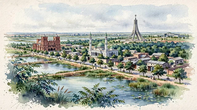
What guided this image
- Landmarks
- Héros Nationaux; Cathedral of the Immaculate Conception; Grand Mosque of Ouagadougou; Bangr Weogo; Kosyam Presidential Palace; Sahelian
- Viewpoint
- Favor an elevated viewpoint overlooking the city near the Barrage reservoirs or Bangr Weogo park, looking toward central Ouagadougou, showing the water and forest canopy in the foreground, with church spires and mosque minarets rising in the middle-ground, and the vast Sahelian horizon fading into the distance.
- Palette
- Green should be the predominant color, especially in the sacred forest of Bangr Weogo, roadside neem and mango trees, and reservoir wetland grasses.
- Guarded against
- Not a generic African desert town
Population2,415,266Wikidata: 1,626,950
Coordinates12.37°N, 1.53°W
Elevation305 m
Area219,300,000 km²
Time zoneAfrica/OuagadougouUTC+0
Solar noon12:06clock runs 0.1 h ahead of the sun
Through the Earth
Dig straight through the Earth from Ouagadougou and you surface nearest to Ahau, Fiji — 155 km from the exact antipodal point.
Nearest cities in the atlas
| Niamey | NE | 414 km |
| Kumasi | GH | 632 km |
| Bamako | ML | 701 km |
| Sokoto | NG | 738 km |
| Yamoussoukro | CI | 741 km |
| Lomé | TG | 757 km |
| Accra | GH | 771 km |
| Ilorin | NG | 791 km |
Twinned cities
- Douala CM
- Kuwait City KW
- Taipei TW
3 of 12 twinned cities are in this atlas. See the full network →
This city sits on
- Burkina Fasocountry
- 12Nparallel
- UTC+0offset