
City
Niamey
Capital of Niger
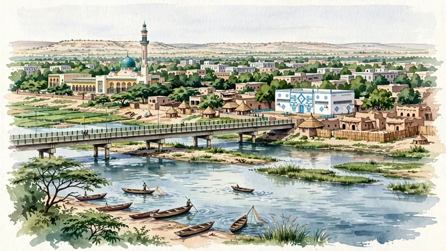
What guided this image
- Landmarks
- Grand Mosque of Niamey; Niger River; Pont Kennedy; National Museum of Niger; Sahelian; Sahelian
- Viewpoint
- Favor an elevated viewpoint along the riverbanks or near Pont Kennedy looking across the Niger River toward central Niamey, showing the river in the foreground, with the green dome of the Grand Mosque rising above the dense neem canopy in the middle-ground, and the vast Sahelian plateau fading into the distance.
- Palette
- Green should be the predominant color, especially in the thick neem and mango canopies, the riverbank gardens, and the green dome of the Grand Mosque.
- Guarded against
- Not a generic Sahara desert village or Arabian oasis
Population1,323,691Wikidata: 233,414
Coordinates13.51°N, 2.11°E
Elevation207 m
Area239,300,000 km²
Time zoneAfrica/NiameyUTC+1
Solar noon12:52clock runs 0.9 h ahead of the sun
Through the Earth
Dig straight through the Earth from Niamey and you surface nearest to Leava, Wallis and Futuna — 92 km from the exact antipodal point.
Nearest cities in the atlas
| Sokoto | NG | 342 km |
| Ouagadougou | BF | 414 km |
| Ilorin | NG | 617 km |
| Kaduna | NG | 668 km |
| Ibadan | NG | 709 km |
| Kano | NG | 715 km |
| Abuja | NG | 768 km |
| Porto-Novo | BJ | 781 km |
Twinned cities
- Dakar SN
1 of 2 twinned cities are in this atlas. See the full network →