
City
Songjiang
China
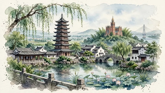
What guided this image
- Landmarks
- Square Pagoda; Zuibaichi Garden; National Shrine of Our Lady of Sheshan; Ming Dynasty Dacang Bridge; traditional Jiangnan water-town architecture; classic Jiangnan flora; Song Dynasty
- Viewpoint
- Favor the classic viewpoint looking across the landscape toward the signature landmarks of Songjiang, showing regional foliage and foreground textures, the iconic architectural monuments in the middle-ground, and the distant horizon fading in the background.
- Palette
- Green should be the predominant color, especially in weeping willows trailing into Fangta lotus ponds, ancient camphor trees, and bamboo groves on Mount She.
Population1,973,500Wikidata: 1,582,398
Coordinates31.03°N, 121.22°E
Area605 km²
Time zoneAsia/ShanghaiUTC+8
Solar noon11:55clock runs 0.1 h behind the sun
Through the Earth
Dig straight through the Earth from Songjiang and you surface nearest to Federal, Argentina — 8 km from the exact antipodal point.
Nearest cities in the atlas
| Minhang | CN | 17 km |
| Qingpu | CN | 17 km |
| Xuhui | CN | 29 km |
| Putuo | CN | 29 km |
| Shanghai | CN | 31 km |
| Pudong | CN | 35 km |
| Yangpu | CN | 38 km |
| Jiading | CN | 40 km |
Twinned cities
Wikidata records no twinned cities for Songjiang inside this atlas.