
City
Vientiane
Capital of Laos
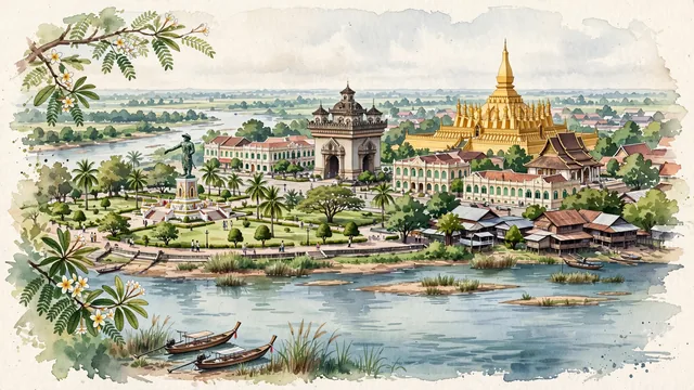
What guided this image
- Landmarks
- Pha That Luang; Patuxai; Wat Si Saket; Mekong River; Chao Anouvong Park; lush tropical urban greenery; Lao; Lao Buddhist
- Viewpoint
- Favor an elevated viewpoint along or across the Mekong River looking toward central Vientiane (such as from Chao Anouvong Park or the riverbanks), showing the calm river waters in the foreground, French colonial roofs and temple spires in the middle-ground, and the golden pyramid of Pha That Luang or Patuxai in the background.
- Palette
- Green should be the predominant color, especially in the tamarind and frangipani trees along Lane Xang Avenue, riverside parklands, and temple gardens.
- Guarded against
- Not Bangkok, Luang Prabang, or Phnom Penh
Population840,940Wikidata: 948,487
Coordinates17.97°N, 102.60°E
Elevation174 m
Area3,920 km²
Time zoneAsia/VientianeUTC+7
Solar noon12:10clock runs 0.2 h ahead of the sun
Through the Earth
Dig straight through the Earth from Vientiane and you surface nearest to San Juan, Peru — 375 km from the exact antipodal point.
Nearest cities in the atlas
| Hanoi | VN | 480 km |
| Bangkok | TH | 520 km |
| Haiphong | VN | 535 km |
| Huế | VN | 557 km |
| Da Nang | VN | 634 km |
| Yangon | MM | 695 km |
| Nay Pyi Taw | MM | 709 km |
| Sanya | CN | 731 km |
Twinned cities
- Bangkok TH
- Beijing CN
- Chattogram BD
- Hanoi VN
- Ho Chi Minh City VN
- Kunming CN
- Phnom Penh KH
7 of 9 twinned cities are in this atlas. See the full network →