
City
Abobo
Ivory Coast
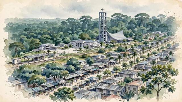
What guided this image
- Landmarks
- Catholic Church of Saint Anne of Abobo; Abobo Town Hall; Abobo; Abidjan; Ivorian
- Viewpoint
- Favor an elevated viewpoint overlooking the commune from the east looking west toward Banco National Park, showing local market streets and courtyards in the foreground, the Saint Anne church tower and civic plaza in the middle-ground, and the colossal emerald forest of Banco filling the background.
- Palette
- Green should be the predominant color, especially in the towering tropical rainforest of Banco National Park, roadside mango trees, and courtyard palms.
- Guarded against
- Not the downtown glass towers of Le Plateau
Population1,340,083
Coordinates5.42°N, 4.02°W
Elevation105 m
Area90 km²
Time zoneAfrica/AbidjanUTC+0
Solar noon12:16clock runs 0.3 h ahead of the sun
Through the Earth
Dig straight through the Earth from Abobo and you surface nearest to Toga Village, Tuvalu — 103 km from the exact antipodal point.
Nearest cities in the atlas
| Abidjan | CI | 8 km |
| Yamoussoukro | CI | 209 km |
| Kumasi | GH | 301 km |
| Accra | GH | 423 km |
| Lomé | TG | 585 km |
| Porto-Novo | BJ | 742 km |
| Monrovia | LR | 756 km |
| Ouagadougou | BF | 820 km |
Twinned cities
Wikidata records no twinned cities for Abobo inside this atlas.
This city sits on
- Ivory Coastcountry
- 5Nparallel
- UTC+0offset