
City
Belém
Brazil
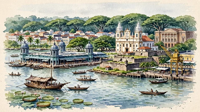
What guided this image
- Landmarks
- Ver-o-Peso Market; Forte do Presépio; Belle Époque Theatro da Paz; Cathedral of Our Lady of Grace; Guajará Bay; Estação das Docas; lush Amazonian vegetation; Amazon Rubber Boom
- Viewpoint
- Favor the classic coastal viewpoint looking across Guajará Bay toward Ver-o-Peso Market and Forte do Presépio, showing water ripples and wooden Amazonian riverboats in the foreground, the historic cast-iron market towers and cathedral in the middle-ground, and the vast green canopy of mango trees and Amazon horizon in the background.
- Palette
- Green should be the predominant color, especially in the colossal overarching canopies of mango trees, açaí palms in Mangal das Garças, and surrounding Amazon rainforest.
- Guarded against
- Avoid confusing Belém with Manaus (Belém has the massive Guajará Bay estuary, Ver-o-Peso market towers, Forte do Presépio, and arched mango tree avenues).
Population1,499,641Wikidata: 1,393,399
Coordinates1.46°S, 48.50°W
Elevation10 m
Area1,059 km²
Time zoneAmerica/BelemUTC−3
Solar noon12:14clock runs 0.2 h ahead of the sun
Through the Earth
Dig straight through the Earth from Belém and you surface nearest to Tobi Village, Palau — 176 km from the exact antipodal point.
Nearest cities in the atlas
| Paramaribo | SR | 1,101 km |
| Fortaleza | BR | 1,134 km |
| Manaus | BR | 1,293 km |
| Georgetown | GY | 1,412 km |
| Brasília | BR | 1,594 km |
| Recife | BR | 1,677 km |
| Maceió | BR | 1,680 km |
| Salvador | BR | 1,690 km |
Twinned cities
- Manaus BR
1 of 10 twinned cities are in this atlas. See the full network →