
City
Chongqing
China
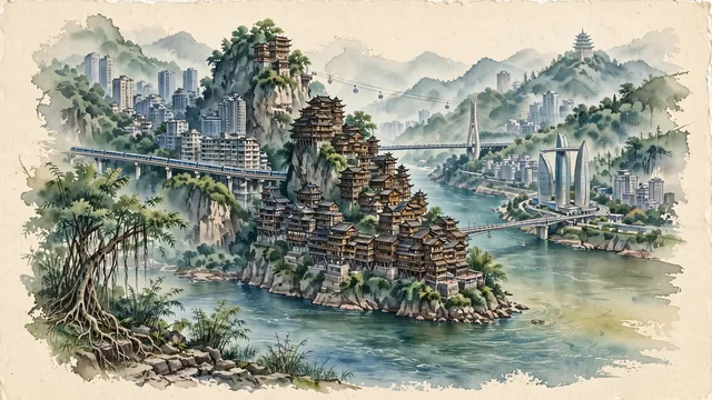
What guided this image
- Landmarks
- Hongyadong; Raffles City Chongqing; Chongqing Rail Transit; South Mountain; Yangtze River; lush subtropical flora; Ba-Yu
- Viewpoint
- Favor the classic viewpoint looking across the Jialing River toward Hongyadong and the Yuzhong Peninsula (such as from the northern bank near the Grand Theatre), showing river waters in the foreground, the cliff-clinging wooden pavilions of Hongyadong and Qiansimen Bridge in the middle-ground, and the soaring peninsula towers and misty Nanshan mountains in the background.
- Palette
- Green should be the predominant color, especially in the thick mountain forests of Nanshan, cliffside banyan trees, and bamboo.
- Guarded against
- Not Chengdu, Wuhan, or Hong Kong
Population7,457,599Wikidata: 28,846,170
Coordinates29.56°N, 106.56°E
Elevation237 m
Area82,403 km²
Time zoneAsia/ShanghaiUTC+8
Solar noon12:54clock runs 0.9 h ahead of the sun
Through the Earth
Dig straight through the Earth from Chongqing and you surface nearest to Coquimbo, Chile — 207 km from the exact antipodal point.
Nearest cities in the atlas
| Neijiang | CN | 145 km |
| Nanchong | CN | 145 km |
| Zigong | CN | 174 km |
| Dazhou | CN | 203 km |
| Zunyi | CN | 211 km |
| Wanzhou | CN | 222 km |
| Bazhong | CN | 257 km |
| Meishan | CN | 268 km |
Twinned cities
- Addis Ababa ET
- Bangkok TH
- Bissau GW
- Brisbane AU
- Budapest HU
- Chennai IN
- Córdoba AR
- Hiroshima JP
- Incheon KR
- Pekanbaru ID
- Phnom Penh KH
- Salvador BR
- Toronto CA
- Voronezh RU
14 of 33 twinned cities are in this atlas. See the full network →