
City
Gqeberha
South Africa
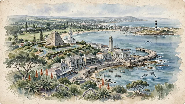
What guided this image
- Landmarks
- Sir Rufane Donkin; Shark Rock Pier; the historic Victorian and Edwardian architecture of Central; Cape Recife Lighthouse; St George's Park; Algoa Bay; lush Eastern Cape coastal flora; British Settler
- Viewpoint
- Favor the classic viewpoint looking from the Donkin Reserve across the stone pyramid and lighthouse toward Algoa Bay and the harbor, showing coastal fynbos and aloe spikes in the foreground, the historic stone pyramid, lighthouse, and Victorian street facades in the middle-ground, and the vast, curving blue waters of Algoa Bay and the Campanile fading in the background.
- Palette
- Green should be the predominant color, especially in the coastal fynbos vegetation, St George's Park tree canopies, and milkwood groves.
- Guarded against
- Not Cape Town, Durban, or East London
Population1,050,078
Coordinates33.96°S, 25.61°E
Time zoneAfrica/JohannesburgUTC+2
Solar noon12:18clock runs 0.3 h ahead of the sun
Through the Earth
Dig straight through the Earth from Gqeberha and you surface in open ocean, nearest to Kīlauea, United States — 1,396 km from the exact antipodal point.
Nearest cities in the atlas
| Bloemfontein | ZA | 541 km |
| Maseru | LS | 545 km |
| Cape Town | ZA | 663 km |
| Durban | ZA | 685 km |
| Soweto | ZA | 882 km |
| Johannesburg | ZA | 894 km |
| Pretoria | ZA | 947 km |
| Lobamba | SZ | 991 km |
Twinned cities
Wikidata records no twinned cities for Gqeberha inside this atlas.
This city sits on
- South Africacountry
- 34Sparallel
- UTC+2offset