
City
Port Moresby
Capital of Papua New Guinea
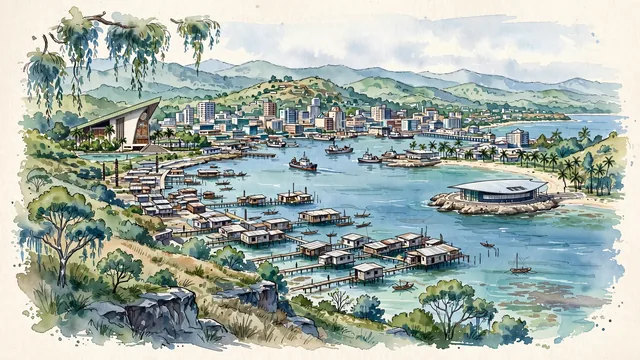
What guided this image
- Landmarks
- National Parliament House; Fairfax Harbour; APEC Haus; Ela Beach; Fairfax Harbour; National Museum and Art Gallery; Haus Tambaran
- Viewpoint
- Favor an elevated coastal viewpoint looking from the hills near Tuaguba Hill or Paga Hill across Fairfax Harbour, showing the stilt houses of Hanuabada and the harbor waters in the foreground/middle-ground, with the downtown ridge or the distinct Haus Tambaran roof of the Parliament House visible in the landscape.
- Palette
- Green should be the predominant color, especially in the coastal eucalyptus hills, rainforest valleys, garden trees, and sea-grass shallows.
- Guarded against
- Not a generic Pacific island town
Population283,733Wikidata: 364,125
Coordinates9.48°S, 147.15°E
Elevation74 m
Area240 km²
Time zonePacific/Port_MoresbyUTC+10
Solar noon12:11clock runs 0.2 h ahead of the sun
Through the Earth
Dig straight through the Earth from Port Moresby and you surface in open ocean, nearest to Nova Sintra, Cape Verde — 1,069 km from the exact antipodal point.
Nearest cities in the atlas
| Honiara | SB | 1,404 km |
| Brisbane | AU | 2,093 km |
| Palikir | FM | 2,194 km |
| Ngerulmud | PW | 2,343 km |
| Dili | TL | 2,372 km |
| Yaren | NR | 2,403 km |
| Port-Vila | VU | 2,462 km |
| Sydney | AU | 2,744 km |
Twinned cities
- Jinan CN
1 of 2 twinned cities are in this atlas. See the full network →
This city sits on
- Papua New Guineacountry
- 10Sparallel
- UTC+10offset