
City
Yaren
Capital of Nauru
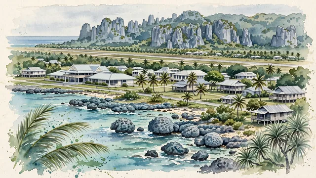
What guided this image
- Landmarks
- Parliament House of Nauru; Government Buildings and Court House; Nauru International Airport; Pacific Ocean; Pacific; Micronesian
- Viewpoint
- Favor an elevated coastal viewpoint looking along the narrow coastal belt from near the reef or lower plateau slopes, showing the turquoise reef surf in the foreground, the Parliament building and palm groves in the middle-ground, and the rugged coral pinnacles of the interior rising in the background.
- Palette
- Green should be the predominant color, especially in the lush coastal coconut palm belt, pandanus groves, and tomano trees.
- Guarded against
- Not a generic tropical resort or high volcanic island
Population1,100Wikidata: 747
Coordinates0.55°S, 166.93°E
Elevation25 m
Area2 km²
Time zonePacific/NauruUTC+12
Solar noon12:52clock runs 0.9 h ahead of the sun
Through the Earth
Dig straight through the Earth from Yaren and you surface in open ocean, nearest to Greenville, Liberia — 668 km from the exact antipodal point.
Nearest cities in the atlas
| Tarawa | KI | 704 km |
| Majuro | MH | 983 km |
| Honiara | SB | 1,254 km |
| Palikir | FM | 1,279 km |
| Funafuti | TV | 1,621 km |
| Port-Vila | VU | 1,917 km |
| Suva | FJ | 2,325 km |
| Port Moresby | PG | 2,403 km |
Twinned cities
Wikidata records no twinned cities for Yaren inside this atlas.