
City
Tarawa
Capital of Kiribati
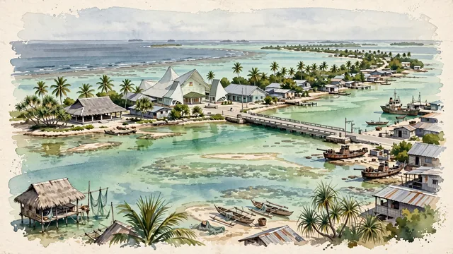
What guided this image
- Landmarks
- Maneaba; Parliament Building of Kiribati; Nippon Causeway; I-Kiribati; Betio; dense coastal vegetation; Micronesian
- Viewpoint
- Favor an elevated panoramic viewpoint looking along the curve of the atoll from near Ambo or Bairiki, showing the Nippon Causeway spanning the water, traditional Maneaba pavilions nestled among palm groves, and the vast contrast between the inner lagoon and the open ocean.
- Palette
- Green should be the predominant color, especially in the thick canopy of coconut palms, pandanus groves, and the luminous turquoise-green shallows of the inner lagoon.
- Guarded against
- Not a high volcanic island or generic Caribbean beach
Population40,311Wikidata: 50,182
Coordinates1.33°N, 172.98°E
Elevation3 m
Area16 km²
Time zonePacific/TarawaUTC+12
Solar noon12:28clock runs 0.5 h ahead of the sun
Through the Earth
Dig straight through the Earth from Tarawa and you surface in open ocean, nearest to Soublaké, Ivory Coast — 636 km from the exact antipodal point.
Nearest cities in the atlas
| Majuro | MH | 665 km |
| Yaren | NR | 704 km |
| Funafuti | TV | 1,294 km |
| Palikir | FM | 1,757 km |
| Honiara | SB | 1,875 km |
| Port-Vila | VU | 2,181 km |
| Suva | FJ | 2,246 km |
| Apia | WS | 2,380 km |
Twinned cities
Wikidata records no twinned cities for Tarawa inside this atlas.