
City
Cần Thơ
Vietnam
What guided this image
- Landmarks
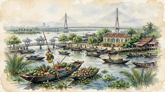
- Cái Răng Floating Market; Ninh Kiều Wharf; Cần Thơ Bridge; Bình Thủy Ancient House; lush Mekong Delta flora; French Indochinese
- Viewpoint
- Favor the classic viewpoint along the river looking across the floating market or Ninh Kiều Wharf toward the Cần Thơ Bridge, showing floating water hyacinths and wooden sampans in the foreground, the active river commerce, bamboo poles, and lotus bridge in the middle-ground, and the soaring cable-stayed towers of Cần Thơ Bridge and the vast delta horizon in the background.
- Palette
- Green should be the predominant color, especially in the thick water coconut palm groves along the canals, floating water hyacinths, and riverside orchard fruit trees.
- Guarded against
- Not Ho Chi Minh City, Da Nang, or Hanoi
Population1,507,187
Coordinates10.04°N, 105.79°E
Time zoneAsia/Ho_Chi_MinhUTC+7
Solar noon11:57clock runs 0.1 h behind the sun
Through the Earth
Dig straight through the Earth from Cần Thơ and you surface nearest to Bolognesi, Peru — 23 km from the exact antipodal point.
Nearest cities in the atlas
| Ho Chi Minh City | VN | 126 km |
| Biên Hòa | VN | 151 km |
| Phnom Penh | KH | 194 km |
| Bangkok | TH | 708 km |
| Da Nang | VN | 720 km |
| Huế | VN | 740 km |
| Kuala Lumpur | MY | 891 km |
| Vientiane | LA | 946 km |
Twinned cities
Wikidata records no twinned cities for Cần Thơ inside this atlas.