
City
Ciudad Juárez
Mexico
What guided this image
- Landmarks
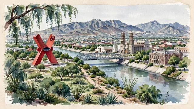
- Mission of Our Lady of Guadalupe; Old Customs House; Rio Grande; Parque Público Federal El Chamizal; Sierra de Juárez; arid Chihuahuan Desert flora; Franciscan
- Viewpoint
- Favor the classic viewpoint from El Chamizal Park or the river embankment looking southwest toward central Ciudad Juárez and the Sierra de Juárez, showing cottonwood branches and desert shrubs in the foreground, the Rio Grande, international bridge, and mission towers in the middle-ground, and the rocky mountain ridges rising in the background.
- Palette
- Green should be the predominant color, especially in the thick cottonwood and pine canopies of El Chamizal Park, desert mesquite groves, and plaza gardens.
- Guarded against
- Not Tijuana, Monterrey, or Mexico City
Population1,512,450Wikidata: 1,321,004
Coordinates31.72°N, 106.46°W
Elevation1,137 m
Area321 km²
Time zoneAmerica/Ciudad_JuarezUTC−7
Solar noon12:06clock runs 0.1 h ahead of the sun
Through the Earth
Dig straight through the Earth from Ciudad Juárez and you surface in open ocean, nearest to Baie aux Huîtres, Mauritius — 1,677 km from the exact antipodal point.
Nearest cities in the atlas
| Phoenix | US | 560 km |
| San Antonio | US | 805 km |
| Mexicali | MX | 852 km |
| Fort Worth | US | 867 km |
| Monterrey | MX | 899 km |
| Dallas | US | 915 km |
| Tijuana | MX | 996 km |
| San Diego | US | 1,012 km |
Twinned cities
- Mexico City MX
- San Diego US
- Tijuana MX
3 of 7 twinned cities are in this atlas. See the full network →