
City
Coimbatore
India
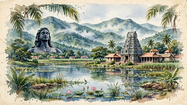
What guided this image
- Landmarks
- Perur Pateeswarar Temple; Adiyogi Shiva; Velliangiri Hills; Valankulam Lake and Singanallur Lake; Tamil; lush Western Ghats flora; Kongu Nadu Chola
- Viewpoint
- Favor the classic viewpoint looking toward the Velliangiri Hills across the lake or from the approaches to Perur Pateeswarar Temple, showing coconut palm fronds and wetland grasses in the foreground, the sculptured stone temple gopuram or Adiyogi silhouette in the middle-ground, and the massive, mist-veiled green mountain wall rising majestically in the background.
- Palette
- Green should be the predominant color, especially in the thick tropical rainforests of the Velliangiri Hills, coconut palm plantations, and wetland lake vegetation.
- Guarded against
- Not Madurai, Chennai, or Kochi
Population2,136,916Wikidata: 959,823
Coordinates11.01°N, 76.97°E
Elevation432 m
Area246,750,000 km²
Time zoneAsia/KolkataUTC+5:30
Solar noon12:22clock runs 0.4 h ahead of the sun
Through the Earth
Dig straight through the Earth from Coimbatore and you surface in open ocean, nearest to Puerto Villamil, Ecuador — 1,739 km from the exact antipodal point.
Nearest cities in the atlas
| Madurai | IN | 175 km |
| Tiruchirappalli | IN | 190 km |
| Bengaluru | IN | 228 km |
| Kallakurichi | IN | 231 km |
| Tirunelveli | IN | 265 km |
| Chennai | IN | 428 km |
| Colombo | LK | 552 km |
| Sri Jayewardenepura Kotte | LK | 561 km |
Twinned cities
Wikidata records no twinned cities for Coimbatore inside this atlas.