
City
Hyderabad
India
What guided this image
- Landmarks
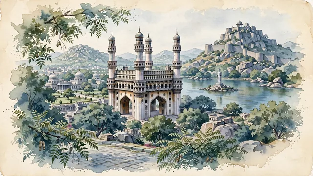
- Charminar; Golconda Fort; Qutb Shahi Tombs; Hussain Sagar Lake; Chowmahalla Palace; lush Deccan Plateau flora; Indo-Islamic Qutb Shahi and Persian
- Viewpoint
- Favor the classic viewpoint looking toward the grand arches and soaring minarets of Charminar from the tree-shaded street or looking across Hussain Sagar toward the Buddha statue with city hills in the background, showing neem tree branches and stone pavers in the foreground, the monumental Charminar arches, balconies, and minarets in the middle-ground, and the rocky Deccan plateau ridges fading in the background.
- Palette
- Green should be the predominant color, especially in the thick canopies of neem and tamarind trees around Charminar, Qutb Shahi tomb gardens, and Hussain Sagar lakefront parks.
- Guarded against
- Not Bangalore, Chennai, or Mumbai
Population6,993,262Wikidata: 6,731,790
Coordinates17.38°N, 78.46°E
Elevation564 m
Area650 km²
Time zoneAsia/KolkataUTC+5:30
Solar noon12:16clock runs 0.3 h ahead of the sun
Through the Earth
Dig straight through the Earth from Hyderabad and you surface in open ocean, nearest to Hanga Roa, Chile — 1,355 km from the exact antipodal point.
Nearest cities in the atlas
| Vijayawada | IN | 252 km |
| Nagpur | IN | 424 km |
| Aurangabad | IN | 430 km |
| Nowrangapur | IN | 478 km |
| Bengaluru | IN | 499 km |
| Pune | IN | 503 km |
| Visakhapatnam | IN | 504 km |
| Shivaji Nagar | IN | 504 km |
Twinned cities
4 of 8 twinned cities are in this atlas. See the full network →