
City
Hyderabad
Pakistan
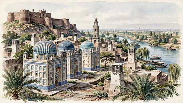
What guided this image
- Landmarks
- Pacco Qillo; Kalhora and Talpur; Sindhi; Shahi Bazaar; Indus River; Navalrai Clock Tower; lush lower Indus valley flora; Kalhora and Talpur
- Viewpoint
- Favor the classic viewpoint looking toward the blue-tiled domes of the Talpur Tombs or the imposing brick ramparts of Pacco Qillo with the rooftop wind-catchers silhouetted against the sky, showing date palm fronds and stone pavers in the foreground, the historic domes, brick bastions, and wind-catchers in the middle-ground, and the Indus River valley horizon fading in the background.
- Palette
- Green should be the predominant color, especially in the thick date palm groves along the Indus River, neem trees, and acacia woodlands.
- Guarded against
- Not Karachi, Sukkur, or Lahore
Population1,921,275Wikidata: 755,290
Coordinates25.40°N, 68.38°E
Time zoneAsia/KarachiUTC+5
Solar noon12:26clock runs 0.4 h ahead of the sun
Through the Earth
Dig straight through the Earth from Hyderabad and you surface nearest to Hanga Roa, Chile — 293 km from the exact antipodal point.
Nearest cities in the atlas
| Karachi | PK | 150 km |
| Rājkot | IN | 424 km |
| Jodhpur | IN | 473 km |
| Ahmedabad | IN | 502 km |
| Quetta | PK | 549 km |
| Vadodara | IN | 600 km |
| Multan | PK | 615 km |
| Surat | IN | 652 km |
Twinned cities
Wikidata records no twinned cities for Hyderabad inside this atlas.