
City
Ahmedabad
India
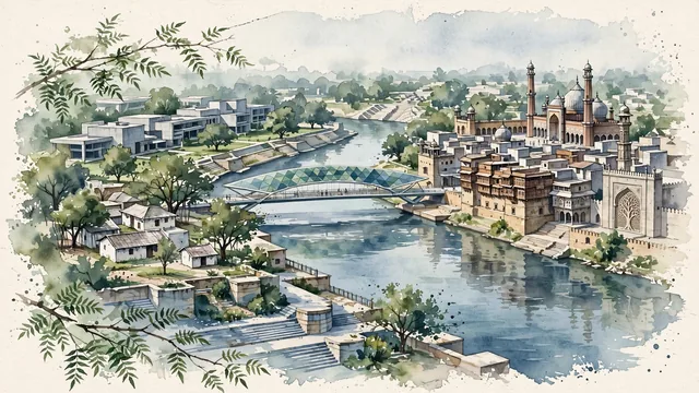
What guided this image
- Landmarks
- Sabarmati River; Sabarmati Ashram; Jama Masjid of Ahmedabad; the dense urban pols of the Old City; Adalaj Stepwell; Corbusier; lush riverside vegetation; Gujarat Sultanate
- Viewpoint
- Favor an elevated viewpoint along or across the Sabarmati River looking toward the historic center and riverfront, showing riverbank neem branches in the foreground, the calm water and stepped promenades in the middle-ground, and the stone minarets and carved wooden haveli rooftops of the Old City in the background.
- Palette
- Green should be the predominant color, especially in the neem and banyan trees around Gandhi Ashram, Sabarmati Riverfront parks, and university grounds.
- Guarded against
- Not Delhi, Mumbai, or Jaipur
Population6,357,693Wikidata: 5,570,585
Coordinates23.03°N, 72.59°E
Elevation53 m
Area464 km²
Time zoneAsia/KolkataUTC+5:30
Solar noon12:40clock runs 0.7 h ahead of the sun
Through the Earth
Dig straight through the Earth from Ahmedabad and you surface in open ocean, nearest to Hanga Roa, Chile — 501 km from the exact antipodal point.
Nearest cities in the atlas
| Vadodara | IN | 103 km |
| Rājkot | IN | 202 km |
| Surat | IN | 205 km |
| Indore | IN | 334 km |
| Nashik | IN | 359 km |
| Jodhpur | IN | 363 km |
| Virār | IN | 398 km |
| Kota | IN | 407 km |
Twinned cities
1 of 5 twinned cities are in this atlas. See the full network →