
City
Kota
India
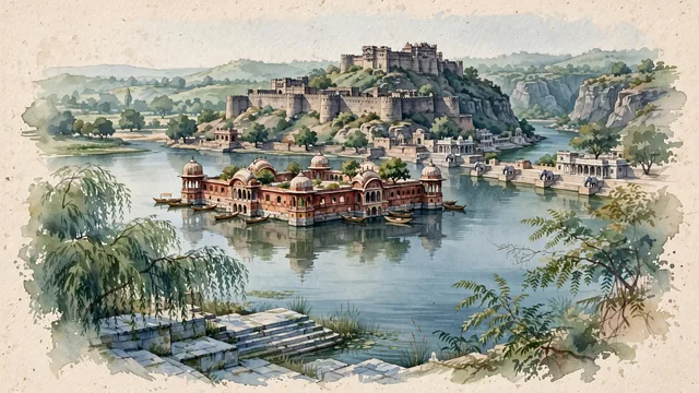
What guided this image
- Landmarks
- Queen Braj Kanwar; Kota Garh; Kishore Sagar Lake; Chambal Riverfront; Garadia Mahadev; Hadoti; lush Hadoti region flora; Hada Rajput
- Viewpoint
- Favor the classic viewpoint looking across the calm waters of Kishore Sagar toward the island palace of Jagmandir with weeping willows and stone ghats in the foreground, showing willow branches and stone lake steps in the foreground, the calm water reflections and red sandstone palace chhatris in the middle-ground, and the distant fortress walls and rolling Hadoti horizon fading in the background.
- Palette
- Green should be the predominant color, especially in the thick canopies of neem and banyan trees around Kishore Sagar, weeping willows along lake parapets, and the forested slopes of the Chambal gorge.
- Guarded against
- Not Jaipur, Jodhpur, or Bundi
Population1,001,694
Coordinates25.18°N, 75.84°E
Elevation271 m
Area527 km²
Time zoneAsia/KolkataUTC+5:30
Solar noon12:27clock runs 0.4 h ahead of the sun
Through the Earth
Dig straight through the Earth from Kota and you surface in open ocean, nearest to Hanga Roa, Chile — 569 km from the exact antipodal point.
Nearest cities in the atlas
| Jaipur | IN | 194 km |
| Gwalior | IN | 261 km |
| Bhopal | IN | 267 km |
| Indore | IN | 274 km |
| Jodhpur | IN | 308 km |
| Agra | IN | 311 km |
| Faridabad | IN | 388 km |
| Najafgarh | IN | 398 km |
Twinned cities
Wikidata records no twinned cities for Kota inside this atlas.