
City
Howrah
India
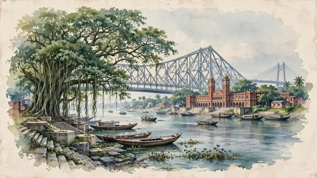
What guided this image
- Landmarks
- Howrah Bridge; Howrah Railway Station; Great Banyan Tree; Vidyasagar Setu; Bengali; lush lower Bengal riverine flora
- Viewpoint
- Favor the classic viewpoint looking along the Hooghly River from a river landing or ghat toward Howrah Bridge and Howrah Station, showing wooden boat prows and riverbank stone steps in the foreground, the sweeping river waters, traditional ferry boats, and Howrah Station in the middle-ground, and the colossal steel cantilever truss of Howrah Bridge rising majestically into the soft sky in the background.
- Palette
- Green should be the predominant color, especially in the colossal canopies of the Great Banyan Tree and Shibpur Botanic Garden, riverbank vegetation, and drifting water hyacinths.
- Guarded against
- Not central Kolkata, Chandannagar, or Dhaka
Population1,027,672Wikidata: 1,007,532
Coordinates22.58°N, 88.32°E
Elevation9 m
Area64 km²
Time zoneAsia/KolkataUTC+5:30
Solar noon11:37clock runs 0.4 h behind the sun
Through the Earth
Dig straight through the Earth from Howrah and you surface in open ocean, nearest to San Juan Bautista, Chile — 1,758 km from the exact antipodal point.
Nearest cities in the atlas
| Kolkata | IN | 5 km |
| Khulna | BD | 130 km |
| Jamshedpur | IN | 220 km |
| Dhanbad | IN | 236 km |
| Dhaka | BD | 248 km |
| Gazipur | BD | 266 km |
| Comilla | BD | 310 km |
| Ranchi | IN | 320 km |
Twinned cities
Wikidata records no twinned cities for Howrah inside this atlas.